Ancient Greece Physical Features: The territory occupied by the Greek nation comprises the southern tip of the mountainous Balkan Peninsula and an intricate complex of smaller peninsulas and islands that define the northeast corner of the Mediterranean Sea.
Ancient Greece Physical Features
Because of this combination of physical features, the topography of Greece is extremely complex and varied. Including all its offshore territory, Greece occupies 131,957 square kilometers.

Greece Geography facts
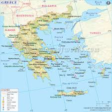
It is bounded on the north by the Former Yugoslav Republic of Macedonia (FYROM–the name internationally approved in 1993 for that entity after its 1991 declaration of independence) and Bulgaria; on the northwest by Albania; on the east by Turkey and the Aegean Sea; and on the south and west by the Sea of Crete, the Mediterranean Sea, and the Ionian Sea.
The sea is the most consistent influence on the physical environment of Greece. The elaborately irregular Greek coastline, one of the longest in the world, includes about 15,000 kilometers of shore.
No point on the mainland is farther than 100 kilometers from the water, and Greece includes more than 2,000 islands–of which about 170 are inhabited. Crete (Kriti), the largest of the islands, is the southernmost point of the nation with a significant population.

Ancient Greece Mountains
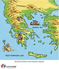
The second major physical features, mountains, cover more than three-quarters of Greece’s surface area. Although their general pattern is from northeast to southwest, the mountains and the basins between them form irregular barriers to movement across the peninsula.
In Greece’s early history, the isolating effect of the mountains encouraged populations to develop lasting traditions of independence because of their lack of communication with the outside world.
Drainage patterns in Greece are affected by the large percentage of land surface covered by rock, by the steepness of the young mountains in the north, which form gorges with narrow, twisting, and fast-moving rivers, and by the deep indentations of the coastline, which shorten the course of rivers across the land mass.
Greek Rivers
The short Greek rivers have irregular seasonal levels that make them unreliable for navigation and irrigation. The three major rivers of Greece–the Vardar (called the Axios by Greeks), the Struma (called the Strimonas by Greeks), and the Nestos (called the Mesta by Bulgarians)–primarily drain other countries to the north and northwest.

The topography of both the mainland and most of the Greek islands is dominated by mountains; Greece has more than twenty peaks higher than 2,000 meters. The most important mountain range is the Pindus (Pindos), which extends from north to south in the center of the peninsula at an average elevation of about 2,650 meters (see fig. 7).
The highest mountain in the range is Mt. Olympus (Olimbos), legendary home of the gods, which is 2,917 meters high.
A southern extension of the Dinaric Alps of the former Yugoslavia and Albania, the Pindus Range consists of several rugged, parallel ridges, the longest of which extends from the Albanian border in the north to the Gulf of Corinth in the south.
Greek Geography Development
Geologically, the range extends across the Gulf of Corinth into the Peloponnesian Peninsula and southeastward to form the islands of the southern Aegean Sea. The northern part of the range offers magnificent scenery of jagged peaks and picturesque gorges.

The continuous settling and shifting of this comparatively young mountain range make the entire region, from Epirus on the Albanian border south to Crete, prone to earthquakes. The Pindus is sparsely populated and generally not cultivated, but upland pasturing of sheep and goats is common.
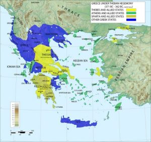
Traditionally, Greece is divided into nine geographic regions that are differentiated by topography and regional tradition but not by political administration. The six mainland regions are Thrace, Macedonia, and Epirus to the north, and Thessaly, Central Greece, and the Peloponnesus farther south.
The three island regions are the Ionian Islands off the west coast, the Aegean Islands in the Aegean Sea between the Greek mainland and Turkey, and the island of Crete, which is considered a separate region. Each region is further divided, for administrative and electoral purposes, into prefectures. There are currently 51 prefectures.
More info on- ancient Greece climate, map, religion